

Satellite imagery has become a popular tool for research and investigations in more and more fields beyond remote sensing science. Investigators and journalists are using it to pinpoint the location of events to better illustrate what is happening in the world. People are constantly finding new applications for the hundreds of satellites documenting the earth on a daily basis.
Here are just a few from NASA’s earth observing data collection, which spans almost two decades:
First, a bit of science
Satellite imagery is a measurement of reflectance from the earth’s surface (or how effective the earth is at reflecting light and other radiant energy). Behind each raw pixel, there is a number that relates to the bands on the electromagnetic spectrum.
While the bands measured can cover a very large range of light reflecting that is imperceptible to the human eye, the most commonly thought of satellite imagery is natural colour imagery, or imagery that measures the visible spectrum. However, combining bands in different ways beyond natural colour can reveal many different things about the surface.
Here are just a few different combinations that can reveal ‘invisible’ things for us to see with agriculture fields in the deserts of Egypt:
Sourcing the imagery
There are many different sources for this imagery available, at varying resolutions and prices ranging from free to hundreds of dollars or more. Here I will focus on those often used for human rights and other non-commercial applications.
Lower Resolution Imagery
If your research does not require a detailed view of the ground, you are in luck since there are a couple of very popular free datasets of imagery resolutions from 10 metres up to 60 metres.
These datasets are Sentinel 2A/B and Landsat (1-8) and can be sourced from a few different places, but here are two common sites where you can find and download the raw imagery files:
- Scihub for Sentinel imagery
- EarthExplorer for Landsat imagery
With this imagery, you will need special geospatial programs and a little knowledge of how to open and view the images, as your computer will not automatically recognize the raw files. One of the most common open source tools for viewing the imagery is QGIS.
For those without any prior knowledge in using or analyzing satellite imagery, there are some great platforms that make viewing the data very easy and user friendly.
- Sentinel Hub (paid platform, but inexpensive and highly recommended for new imagery users)
- Remote Pixel
- Google Earth Engine (requires some coding knowledge)
Using the imagery, it can be possible to find changes over time that occur within an area of 10 metres or more. Some things you might be able to document are:
- Floods or droughts
- Large-scale deforestation
- Burned land/fires
- Major glacier changes
- Open-pit mining
- Crop health or destruction
- Large-scale demolition or destruction
- Oil spills
Of course, all of this data can be misinterpreted so please check with an expert if you are planning to make any groundbreaking conclusions.
Since Landsat imagery goes back to 1972, at 60 metre resolution, it is particularly good for large changes over time, such as deforestation in the Amazon, shifts in agriculture, glaciers melting, and other things. Google Timelapse shows how dramatic some of these changes have been, and that is only using Landsat imagery from 1984 to 2018.
Higher Resolution Imagery
If you are looking for something in more detail, you will need to access higher resolution imagery. At this point, the best resolution satellite imagery (we will not be talking about drone imagery here) accessible to the general population is 30cm.
This level of resolution can reveal much more information, such as:
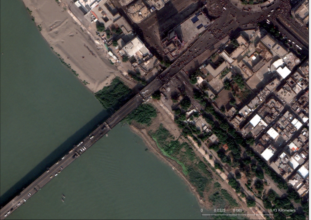
- Types of vehicles (passenger car versus truck)
- Pedestrian crossings, traffic lights, other city street features
- Groups or long lines of people
- Variations in trees (different types or heights)
- Distinguishing details of planes, vehicles, ships
- Damage, destruction or debris in a small area
For the higher resolution imagery, the most important question is how recent the imagery needs to be. If you are able to use older imagery there are many sources available for free. Some of these are:
- Google Earth (desktop version preferred with my work)
- Bing Maps
- Zoom.Earth
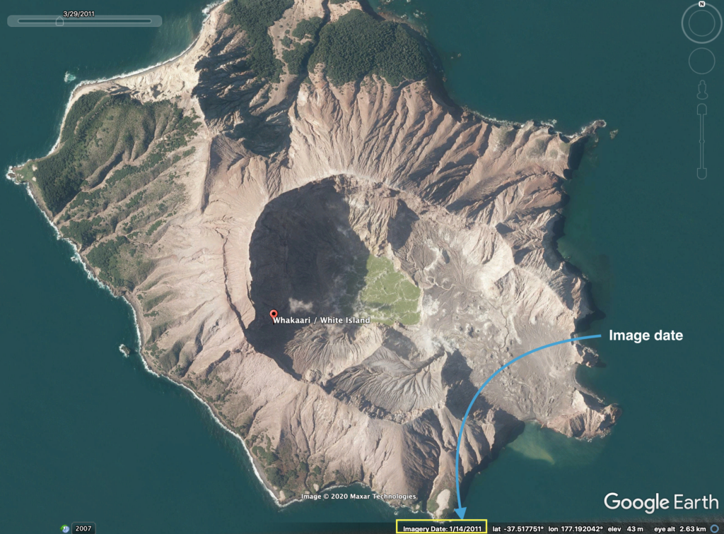
Depending on where in the world you are looking, the imagery could be months or years old. If the date of the image matters, be sure to research how to find the date of the image you are looking at, depending on the source you are using.
Here is where to find it on Google Earth Pro Desktop (be aware, the dates can be approximate):
For more recent imagery, you will likely need to purchase it, which can vary significantly in price depending on size, resolution and date of capture. Prices can range from around $200 and up per image.
For those familiar with ordering imagery, you can work directly through the commercial satellite imaging companies but will need to become an approved customer first:
If you need a little help getting through the ordering process, there are multiple resellers selling imagery from the companies above and many others that can assist:
Purchase of the imagery above requires a minimum order amount, but you get the raw images, allowing you to do more in-depth analysis if needed. If all you need is a quick image of a smaller area, there is no perfect, cheap solution, but two to check out are:
This list covers what I typically use or hear about most often in the human rights field. For a more comprehensive set of options, check out this list compiled by Harel Dan.
And let us know what cool things you find!